Wight Conservation - History and Archaeology
 Introduction Introduction
Wight Conservation’s landscapes reflect the long history of man’s habitation
on the Island as well as telling some of the complex geological story. The ridge
of chalk downs stretching from west to east across the south of the Island,
which dominates much of our estate, is some 60 million years old and was thrown
up by the same upheavals that brought the Alps on the continent into being.
The landscape that we see today has been formed by man’s activities over
thousands of years. Indeed, it is the management in pursuit of agriculture and
economic activities such as quarrying that has given the special character that
we cherish today. (LINK: Woodland Management) No part
of our estate is truly wilderness, untouched by human hand, and, although the
management priorities today include wildlife and habitat diversity, many of the methods employed reflect
our forebears’ need to use nature to their advantage, first for survival and
later for economic progress. Without careful and sustained management, the
estate’s diversity would quickly deteriorate as dominant species take over.
Neolithic
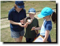
The earliest signs of man’s activities on the estate that we have so far
identified are Neolithic flint workings that would have produced tools needed in
abundance for a whole range of agricultural, woodland and domestic operations.
Recent archaeological survey work carried out by the National Trust (Ventnor
Downs Historic Landscape Survey - CKC Archaeology) has identified Wroxall Down
as being part of a settlement occupied for well over 4,000 years.
 Bronze Age Bronze Age
But the first civilisation to leave significant marks on the landscape is the
Early Bronze Age people (c2,400 to c3,000 BCE) with their burial barrows that
are such prominent features on the downs across the Island. These cemeteries
were often fashioned on false crests so they would be visible from below - a
constant reminder, no doubt, of mortality. It seems that the layout of the
barrows may well have formed the boundaries between lands of tribes or families
and it is interesting to note that the current division between the modern civil
parishes of Wroxall and Ventnor runs along one of these ancient boundaries.
Early Trade
These people were far from isolated, living in societies that enjoyed trading
and cultural links with other ancient civilisations as far away as the
Mediterranean. A burial urn found in one of the Mottistone Down cemetery barrows
by the Rev. Green’s excavation in the early 1800s has decoration similar in
style to pottery of the same period from the Ionian islands of Lefkas. (LINK:
The Prehistoric Ceramics Research Group)
www.pcrg.org.uk
These people would have had a good working knowledge of the tides, currents and
weather of the Solent and the Channel. The waters would have been no less
treacherous to navigate than they are today. Some recent experiments have shown
that primitive craft of the period would have been quite seaworthy and capable
of coping with rough seas.
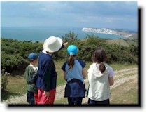
Sheltered by St Martin’s Down, Luccombe Down and Ventnor Down from the winds,
the broad, flat coombe (or valley) of Wroxall has always been favoured farming
land, watered by springs and tributaries that rise in the area as the headwaters
of the Eastern River Yar. In the drier, hotter climate of the Early Bronze Age,
our ancestors adopted the terracing method of cultivation - remains of which can
be seen today – to preserve water. As well as burying their dead on the downs,
they would have grazed their cattle, sheep, pigs and goats on this high ground. Their settlements would have been in the
valleys in much the same areas as today’s villages and farmsteads.
Saint Boniface
Christianity was late in coming to the Isle of Wight, but St Boniface Down,
which borders Wight Conservation’s Wroxall estate, is a reminder that one of the
greatest missionaries of the early Medieval period visited the Island. Born in
657CE, St Boniface entered Nursling monastery near Southampton and became a monk
and a priest. He would have seen the Island whilst undergoing his training and
novitiate and, knowing that Christianity was only just taking root there, could
well have conceived his missionary work. No doubt he would have made several
visits, cutting his missionary teeth on the hesitant islanders hedging their
bets as to whether to give up their pagan worship - some of the barrows show
evidence of Christian burial from this period. As he walked and meditated along
the Wroxall Horseshoe, looking across the Channel, perhaps inspired the greatest
of his life’s work as a missionary on the Continent. (LINK:
www.stboniface.org.uk/whowas.htm)
Norman Conquest
Some 400 years later we know that Wroxall Manor Farm estate belonged to King
Harold’s mother before the Norman Conquest, after which it passed to the Crown.
(LINKS: Society of Medieval Archaeology -
www.socmedarch.org ; The
Medieval Settlement Research Group -
www.britarch.ac.uk/msrg)
Its descent can be directly traced through a number of families to Lord
Yarborough (of Appuldurcombe) in the 1840s.
Of special interest is Wroxall Copse which is probably the woodland mentioned in the Domesday Book for this
manor. It is a good example of woodland pasture - Domesday refers to pig grazing
- which existed as a long strip between the down and the arable land below, very
much as it does today.
A legal dispute in 1617 regarding grazing and other rights on these downs
indicates that the area was a valuable agricultural resource for livestock and
that the various quarries and earthworks were an important source of building
and road making materials.
Agriculture
Ploughing up the downs for arable cultivation goes back to the Napoleonic wars
when there was an urgent need to increase food production to fee the nation in
war time conditions. This was repeated during World War I and again in 1939-45
and meant that a valuable habitat was lost. Similarly, the planting of conifer
forests after the timber shortages of World War I has changed many landscapes
across the country, Wight Conservation’s Brighstone Forest being a good example.
Concern for the beauty of the downland goes back over 80 years when 221 acres of
St Boniface Down were presented to the National Trust by Llewellyn Evans. Today,
our conservation priorities are conserving the historic landscapes and natural
beauty as well as improving habitats and biodiversity. Conservation grazing with
the fold of Highland cattle (LINK: Highland Cattle) is returning the downland to
its ancient usage before it went under the plough in the interests of national
survival.
 Wroxall
Cross Wroxall
Cross
The indications are that Wroxall Cross farmhouse was built in the 1780s; there
are similarities in some architectural features and building materials with
Appuldurcombe House which was extended about that time.
When Wight Conservation purchased the old stone farm buildings they were unused,
unoccupied and badly in need of maintenance – modern farming methods has made
such accommodation largely redundant. They have been rejuvenated by retiling all
the roofs, and strengthening and re-pointing where necessary. All the buildings
are now in use. The big barn acts as a lecture/conference centre. The old
hayloft and dairy have now been converted into 2 self-contained dwellings and
the latter is now available for self-catering holidays. The
modern barns have all been repaired and are employed as cattle shelters,
machinery storage or stables. Electricity has been laid on to all buildings.
Ventnor Railway
In the 1860s the railway came to Wroxall from Ventnor. This meant the
constructing of a tunnel under the estate, a remarkable feat of Victorian
engineering which is still in good condition today, though it is now only used
to carry water and other services. Like the other lines on the Island, this was
a speculative venture to encourage expansion of Ventnor as a holiday
destination. The Victorians, like earlier peoples, recognised its favoured
climate. The story of its construction well illustrates the financial and
engineering problems that new railways encountered and the vision and
determination of their promoters to overcome them.
World Wars I & II
Wight Conservation’s estate has been in the front line in time of war in more
recent years. One of the barrows in the Mottistone Down cemetery, used as a
beacon at the time of the Spanish Armada and later, was adapted as an
observation post in World War II. The concrete base of a building can still be
seen.
More dramatically the Wroxall estate witnessed some fierce aerial battles
between 1939 and 1940 with the downing of five German aircraft. The enemy prize
was the knocking out of Ventnor Radar; one of the original wooden towers can
still be seen from the estate, thought it is now used as part of the National
Air Traffic Control Network.
Ventnor Radar Station features in the 1960s film The Battle of Britain. It was
only ever put out of action for brief periods.
Two bombers, a Junkers 88 and a Dornier 217, crashed on St Martin’s Down, as did
a ME 109 fighter whose pilot is still alive today. He was captured by two
elderly members of the local Home Guard, armed with a rifle and bayonet between
them, who demanded souvenirs. In order to placate these menacing gentlemen, the
pilot broke his prize Luftwaffe sun goggles in half so neither would do better
than the other.
Greatwood Copse is the site of another crashed ME 109 which went down a well
(the pistons can be seen in the Isle of Wight Military History Museum), and a
further Junkers 88 ended up in Wroxall Copse. (LINK:
http://www.warbirdart.demon.co.uk/echoes.html)
Amongst other defences countering what must have been some very dramatic raids
was the now extremely rare Alan-Williams turret still in its original location
on the estate. Like static tank turret, it could be rotated through 360 degrees
and would have been armed with a machine gun that could be elevated for use in
the anti-aircraft role. This was one of the many emergency defensive measures
put in place in 1940 after Dunkirk when invasion loomed and everything was
thrown into the battle for survival. (LINK: The Defence of Britain Project -
www.britarch.ac.uk/projects/dob/ )
1987 Great Storm
Nature, of course, has a hand in causing often dramatic changes to the
environment and plays a part in the making of the history of the landscape.
Within the last two decades the Great Storm of October 1987 caused the
destruction of a huge number of trees across the Island, many from salt deposits
rather than wind blow. At the time this was seen as something of an
environmental disaster, but in a number of areas this has been turned into an
advantage. The damage caused to the conifer planting on Mottistone Down (dating
back some 70 years – see above) gave the impetus to clear the site and begin the
process to recreate the original chalk downland. (LINK:
Grassland Management)
Wight Conservation is proud of these historical connections and works closely
with English Heritage, the Isle of Wight Archaeology Service and other bodies to
record, conserve and repair archaeological and historical features.
John Patron
Further useful links:
Council for British
Archaeology
English Heritage
|